Russians start jamming GPS near the port in Novorossiysk

OSINT analyst H I Sutton reported that the Russians had installed a GPS jamming complex near the port of Gelendzhik in Novorossiysk.
Here's What We Know
The analysis used information from the Automatic Identification System (AIS), which is used in civilian shipping. Thus, during the AIS analysis, the analyst noticed that the location of the Russian ships differed from their actual location.
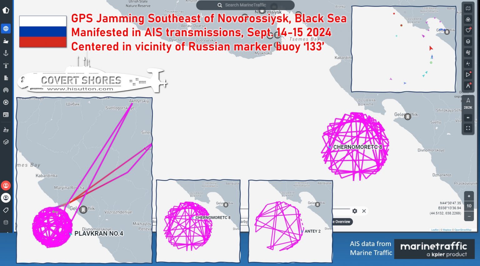
According to H I Sutton, the interference is concentrated in the area of the Russian marker buoy No. 133, which is why the location of ships using the global positioning system shows a false position.
The GPS jamming complex is aimed at combating Ukrainian special services that could see the location of the ships.
Interestingly, the misplacement of the Russian ships in Novorossiysk was also noticed by the Crimean Wind monitoring group, which drew attention to the ships' location on land.
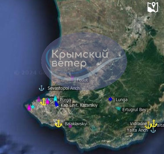
In parallel to Novorossiysk, the installation of a similar GPS jamming system was spotted in July in Crimea and around Sevastopol.
It is worth noting that the Automatic Identification System (AIS) is a set of devices designed to monitor and exchange information about ship movements. AIS transmits real-time data on the location, course, speed and other characteristics of ships. The main purpose of AIS is to improve maritime safety, prevent collisions and support shipping management.
Source: H I Sutton