Google Maps and Search extend wildfire monitoring to 15 new countries in Europe and Africa

Since 2020, Google Maps and Search have been showing the boundaries of nearby wildfires. This feature is now being rolled out to more countries in Europe and Africa.
Here's What We Know
According to The Keyword, Google has announced that wildfire boundaries and information will now appear in Search and Maps in 15 new countries, bringing the total to 22, including the US, Canada, Mexico, Australia, and more.
The new regions include:
- Andorra;
- Bosnia and Herzegovina;
- Croatia;
- Cyprus;
- France;
- Greece;
- Italy;
- Kenya;
- Monaco;
- Montenegro;
- Portugal;
- Rwanda;
- Slovenia;
- Spain;
- Turkey.
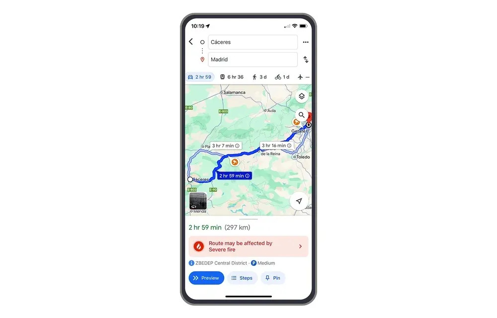
Google explains that its artificial intelligence has already mapped more than 40 wildfires in Southern Europe this summer, including fires in Spain, Greece and Cyprus. This information is available through phone alerts and driving directions, helping people stay safe. In the first week of July, 1.4 million people saw information about wildfires in Europe and Africa.
Source: 9to5Google