Nuclear weapons storage base and secret test sites: Google Maps reveals high-quality satellite images of Russia's strategic facilities

The Google Maps service now provides satellite images of Russian military and strategic facilities in maximum resolution. Note that they were displayed before, but in much worse quality - now you can see the details with a resolution of about 0.5 meters per pixel.
Thanks to these satellite images, you can see the nuclear weapons storage base near Murmansk, the Nenoksa test site, where the secret nuclear-powered Burevestnik missile went off, the Russian aircraft-carrying cruiser Admiral Kuznetsov, various secret bases and airfields. You can also look for the bunker where Putin is hiding.
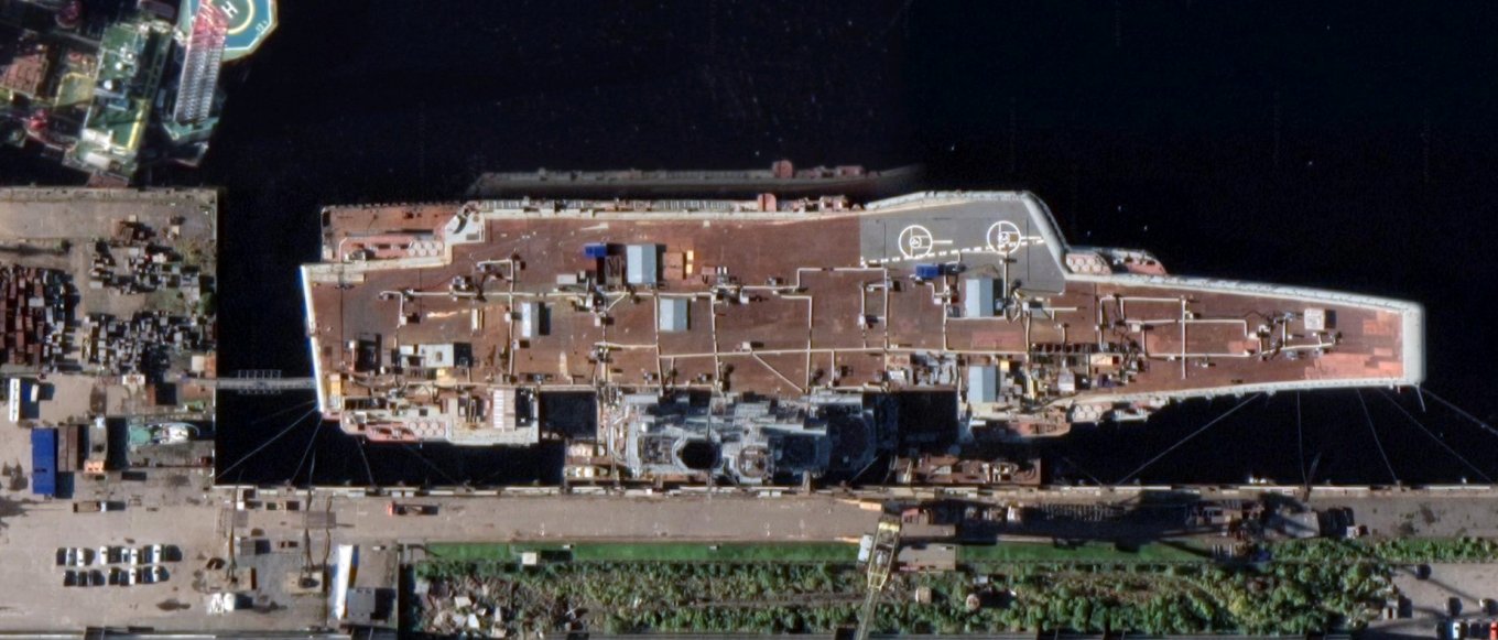
Cruiser "Admiral Kuznetsov"

Nuclear weapons storage base near Murmansk

Nenoksa polygon
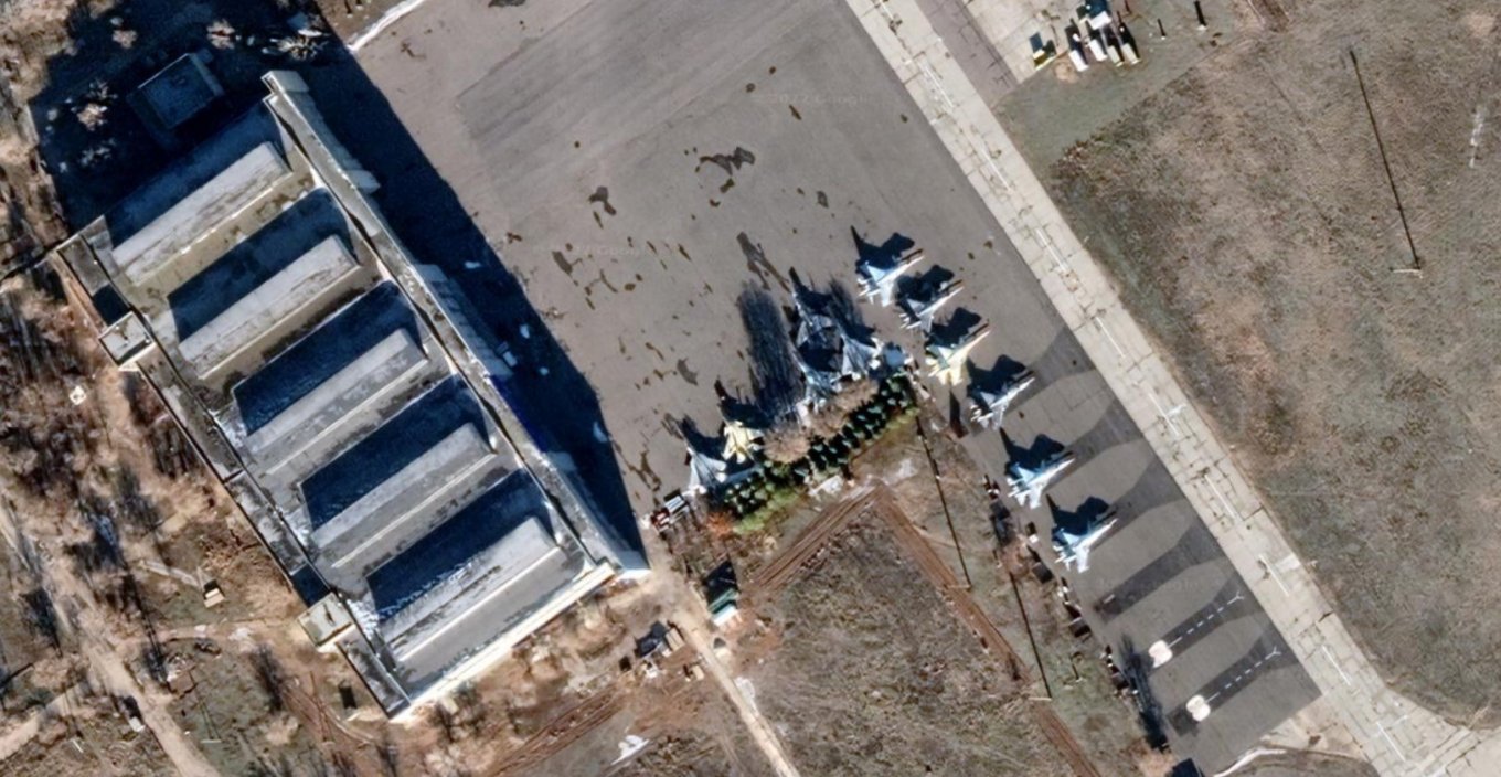
Fighter 5-generation Su-57 in the flight test center of the Ministry of Defense of the Russian Federation

Launch position of an intercontinental ballistic missile
Defense Express notes that such images are unlikely to have strategic value, since military satellites provide images in better resolution, but you may be interested in "wandering" through the secret places of the Russian Federation.
Source: Defense Express
For those who want to know more:
- “The Americans wrote in Ukrainian letters in the Ukrainian language”: the occupiers read the instructions on the Polish RPG-76 Komar (video)
- The first photo of the sinking cruiser Moskva appeared: what does it say about the effectiveness of the Ukrainian Neptune missile
- Why postcards with the image of a multiple launch rocket system appear on social networks on Palm Sunday
- These photos of a wrecked occupant's tank are circulating on social media, they look like works of photographic art
Sanctions in action: production of T-90 and T-14 tanks (Armata) stopped in Russia