NASA showed what the front line in Ukraine looks like from space: HIMARS tried to make a pretty picture

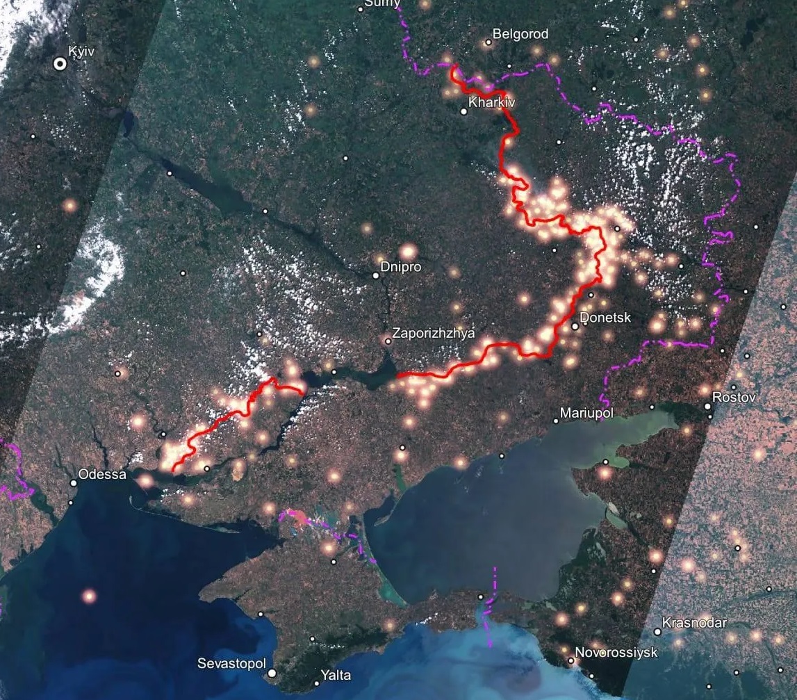
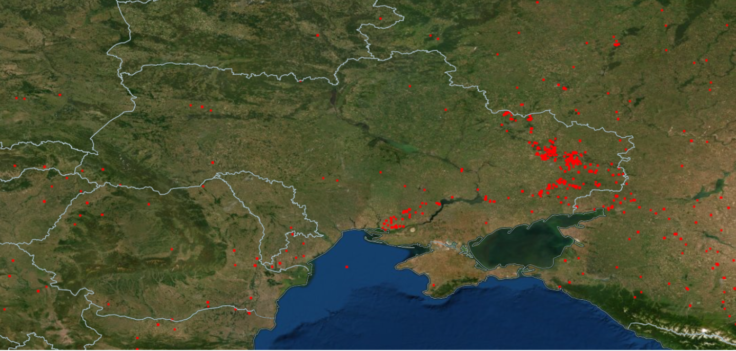
The space agency NASA published photos of the front line in Ukraine taken from space.
What we know
The National Aeronautics and Space Administration with the help of FIRMS system was able to fix the hottest points on the front. Areas engulfed in flames were fixed by satellites, which perform monitoring of big fires.
The pictures show the main fire spots concentrated in the south of Ukraine (Mykolaiv and Kherson regions) and in the east (Luhansk, Donetsk and Kharkiv regions). It should be noted that the number of fires on the front line and in the temporarily occupied territory increased significantly after the Armed Forces of Ukraine received multiple rocket launchers HIMARS.

Within two weeks, more than two dozen Russian army ammunition depots were destroyed. Virtually every morning, the media report on strikes against military facilities of the occupants in Donetsk, Luhansk, and Kherson regions. For example, on the morning of July 10, a missile strike was launched against a military unit in Kherson.
Source: FIRMS
For those who want to know more:
- Beautiful video of M777, HIMARS and Javelin destroying Russian tanks, ammunition depots and military bases published
- Canada will send LAV II ACSV armored vehicles with 7.62 mm machine guns to Ukraine in July
- U.S. senators call for sending long-range missiles to Ukraine for HIMARS
- Ukrainian Drone Army sends first DJI Mavic and DJI Phantom drones to the front
- Ukrainian military created a kamikaze drone without waiting for MQ-1C Gray Eagle deliveries