From Foam Planes to Universal SKIF Platform: the History of the Ukrainian Company Culver Aviation

Along with pain, death, and considerable destruction, wars have always greatly accelerated technological progress. For example, mankind entered World War II with aviation using reciprocating internal combustion engines, and ended with jet engines. Now this technological leap is being made with unmanned aerial vehicles (UAVs). Of course, we have all heard about successes of Turkish Bayraktars or Armed Forces of Ukraine will receive 20 PD-2 drones worth $8,500,000. But sooner or later all technology created for war and destruction begins to be applied to the economy of the peaceful times. To imagine the scope of these changes, let's take the Internet as an example - how and for what purpose it was created, and what it has become for mankind today.
Ukraine is not only a country of courageous warriors able to resist a much stronger aggressor. It is also a country of inventors, talented engineers, and tenacious programmers who can produce world-class products and services. We should be inspired by such examples and study their history. Who among you has heard of the company Culver Aviation? After all, it is the same example of a Ukrainian organization that has gone from dreams and the first prototypes in a garage to a modern complex of universal applications that can withstand the highly competitive pressure in a global market where dozens or even hundreds of similar companies already exist.
The online meeting with the founders of the company was special for me - for the first time in my life I was in the role of an interviewer. Feeling the burden of responsibility, I felt nervous at the same time, because I could not even see the faces of the people to whom I was asking questions (the head of the company was literally caught in the middle of the field, where he had to stop to answer my questions). I'll also be frank, I knew next to nothing about UAVs. It was one thing to talk and write about games, which is what I had been doing all along as a journalist before the full-scale war. But here I had to change vector drastically and find out, for example, what the different form factors of UAVs are and what the resolution of today's digital maps are. This communication is really not only amazing and inspiring. If in war times there are entrepreneurs planning and developing ultra-modern high-tech products for peacetime, then we really are an invincible nation that will overcome any obstacles.
Where did it All Begin?
In April 2014, when the war in Donbass began, people who wanted to help our fighters showed up. This is how the volunteer group EyeTech appeared in Kyiv, which would eventually turn into SPC ITEC. Its goal was to create Ukrainian air monitoring systems that saved the lives of our warriors. The first steps of EyeTech are comparable with Apple, because the first planes were assembled in a garage at their own expense. No one thought about offices, big team, or contracts back then. There was only the desire to create something of our own and help our warriors. When creating, the basis was the foam planes and electronics purchased in China and assembled in Ukraine.
The results were immediate - at the end of September, they produced the first samples of drones and presented them at an exhibition at the State Aviation Museum of Ukraine. At that time, a new technology industry began to emerge in Ukraine.
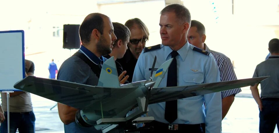
One of the first exhibitions where Eyetech demonstrated its developments. State Museum of Aviation of Ukraine, 2014 (Source: ITEC)
Regular tests in different regions of Ukraine gave birth to better and better modifications of the aircraft, it had a French autopilot, but it was still very far from modern UAV standards. For example, it transmitted the coordinates of its location rather than objects caught by the camera.
New Changes
In December 2014, the EyeTech team evolved into SPC ITEC. The team was making custom airborne reconnaissance complexes and continued to improve them. The main driver of development in those days was the military, so the team listened to their comments. And also worked out the necessary functionality: installed a high-precision camera, thermal imager, a battery providing up to 2 hours of flight time.
From 2014 to 2016, ITECH managed to make several dozen aerial reconnaissance complexes. And the military, assisted by ITECH UAVs, handed over certificates, commendations, and a Ukrainian flag signed by the fighters.
Change of Vector and Investments
In 2016 it became possible to produce composite bodies - with kevlar, fiberglass and carbon fiber, to set the calculated aerodynamics to easily reproduce it. The company also conducted intensive training for employees, and set up the production of small-scale products.
In mid-2016, the company had a turning point - they realized the prospect of a UAV for civilian use and focused entirely on it. ITES focused on the agricultural sector, very soon concluded its first contracts with major market players and continued to develop in this direction.
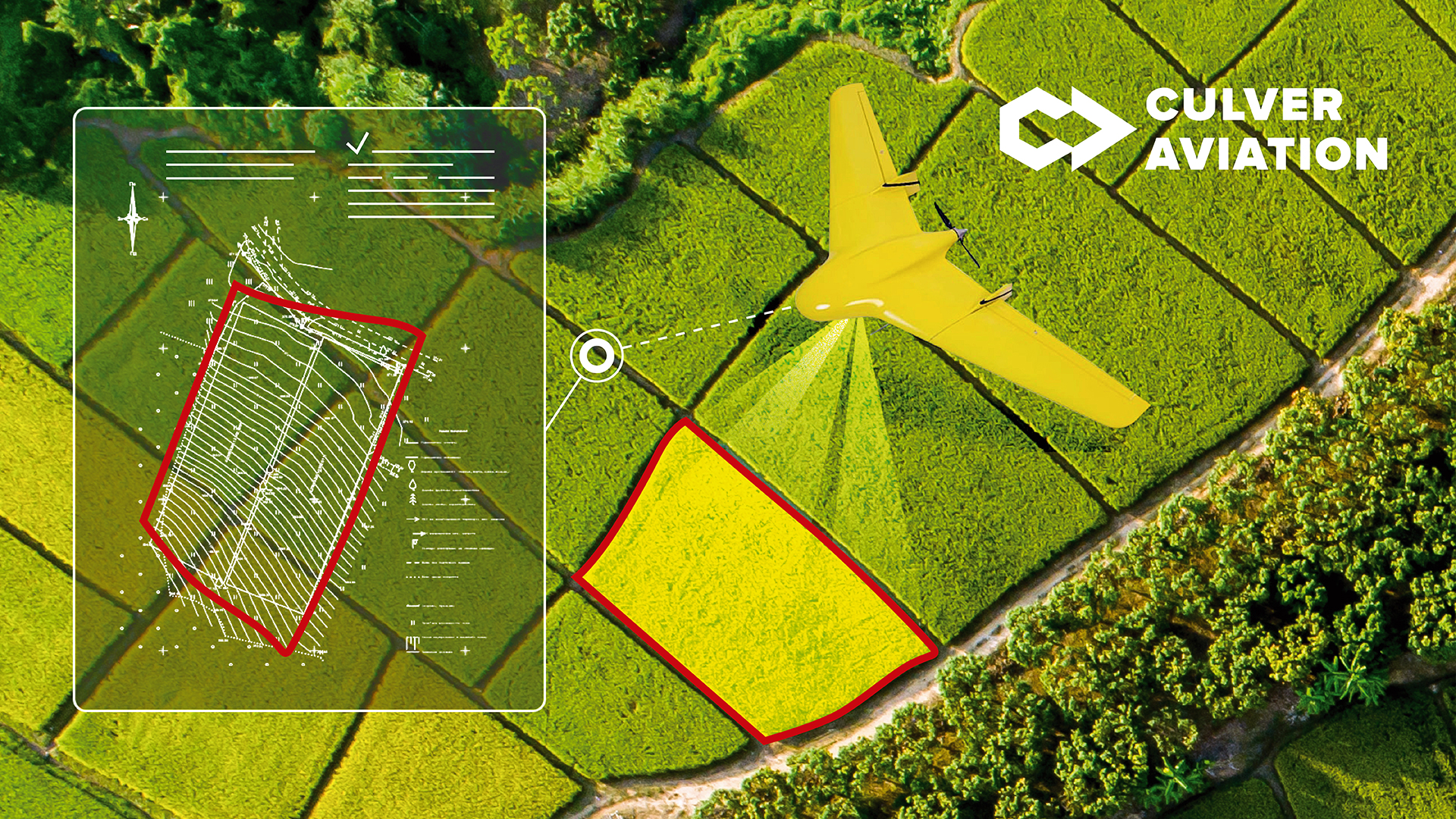
In 2021 TECHIIA Holding invested in the company and created Culver Aviation on its basis. The company does monitoring - aerial photography, crop condition monitoring, field measurement, heat source search and identification. And mapping - creating visual and NDVI maps (Normalized difference vegetation index) - this is a numerical indicator of the quality and quantity of vegetation on the field area. It is also a topographic maps, water scarcity maps and creation of orthophotomaps - digital image of the area using aerial photographs.
Could anything have been done any other way by starting all over again? Oleksandr has two points of view on this question - on the one hand, there was no other way in Ukraine, and now they would have chosen more or less the same thing. On the second, as Oleksandr says: "I should have gone abroad, where the rules and dynamics are different. I would have spent much less time than here."
For Those Who Want to Know More: What Affects the Flight?
The distance and duration of the flight of the SKIF UAV
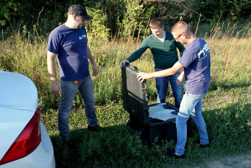
To begin with, the preparation time for the launch is 15 minutes. The flight duration is up to 2 hours, and the maximum distance is 130 km. I should note that the flight time and distance depends on weather conditions and the complexity of the route. The UAV is lifted into the sky by automatic launch from the hands, using an elastic catapult 40 m long. An optional catapult launch from a pickup catapult is also possible.
UAV catapult launcher
Weather conditions
Recommended wind speed - up to 10m/s in flight. Maximum allowable speed - up to 14m/s in flight. Operating temperature -15 to +35°C.
Landing the UAV in winter weather
SKIF Introduction and its Capabilities
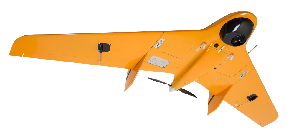
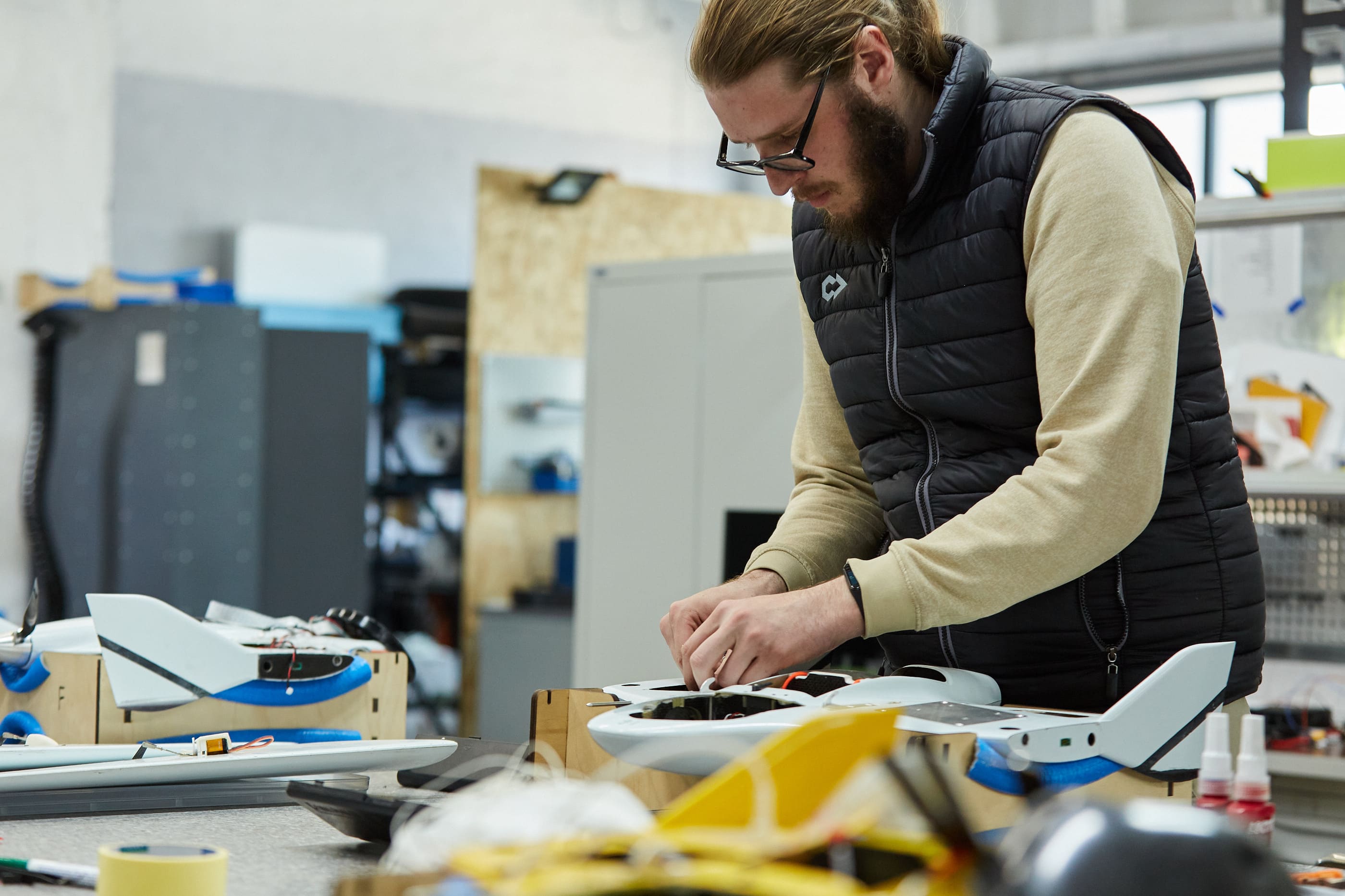
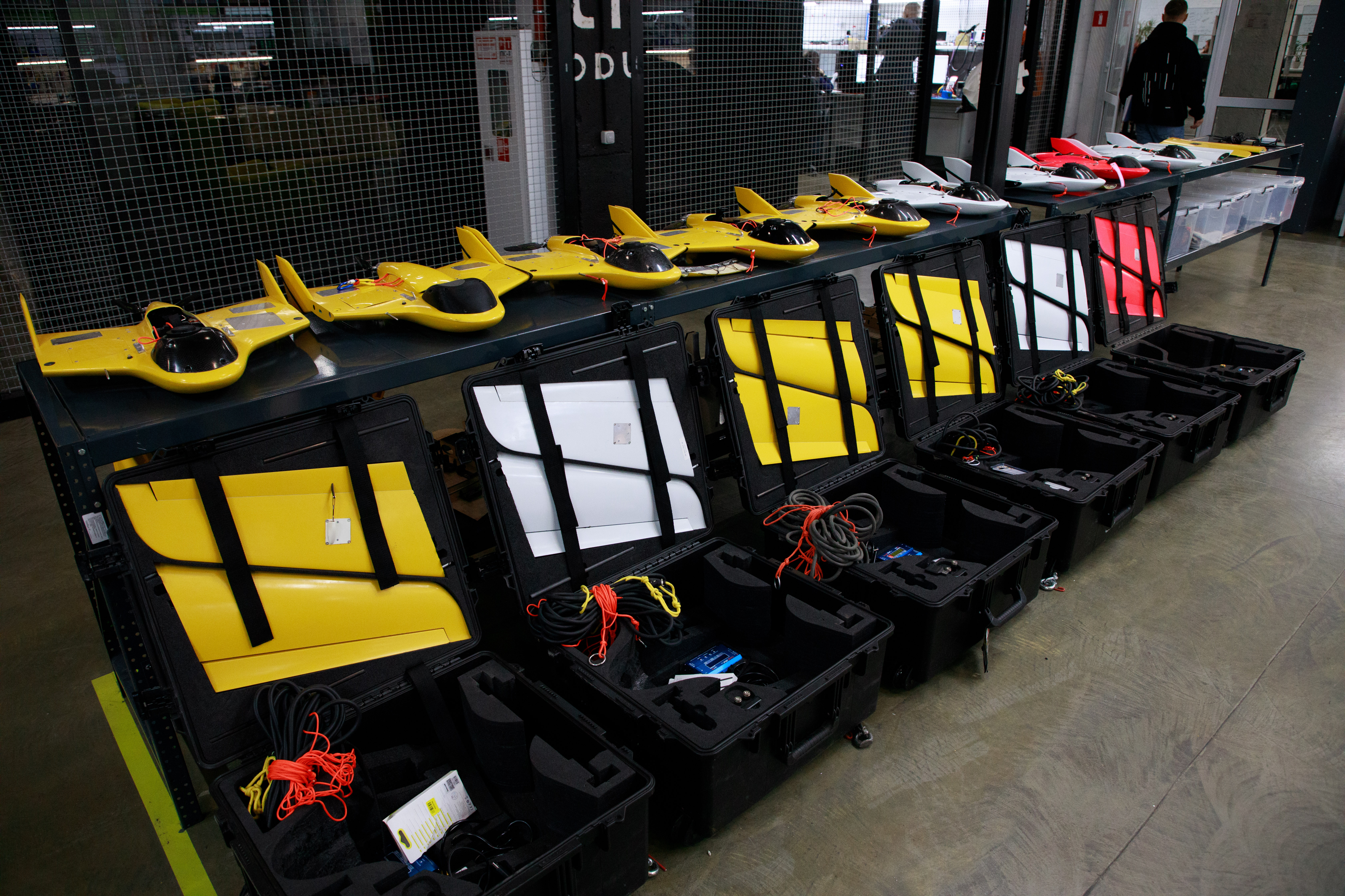
After two years of testing and dozens of attempts, ITEC began to put more and more of its electronics and algorithms into the aircraft. And in the fall of 2015, they began designing their own body, and the following year the SKIF UAV body was unveiled.
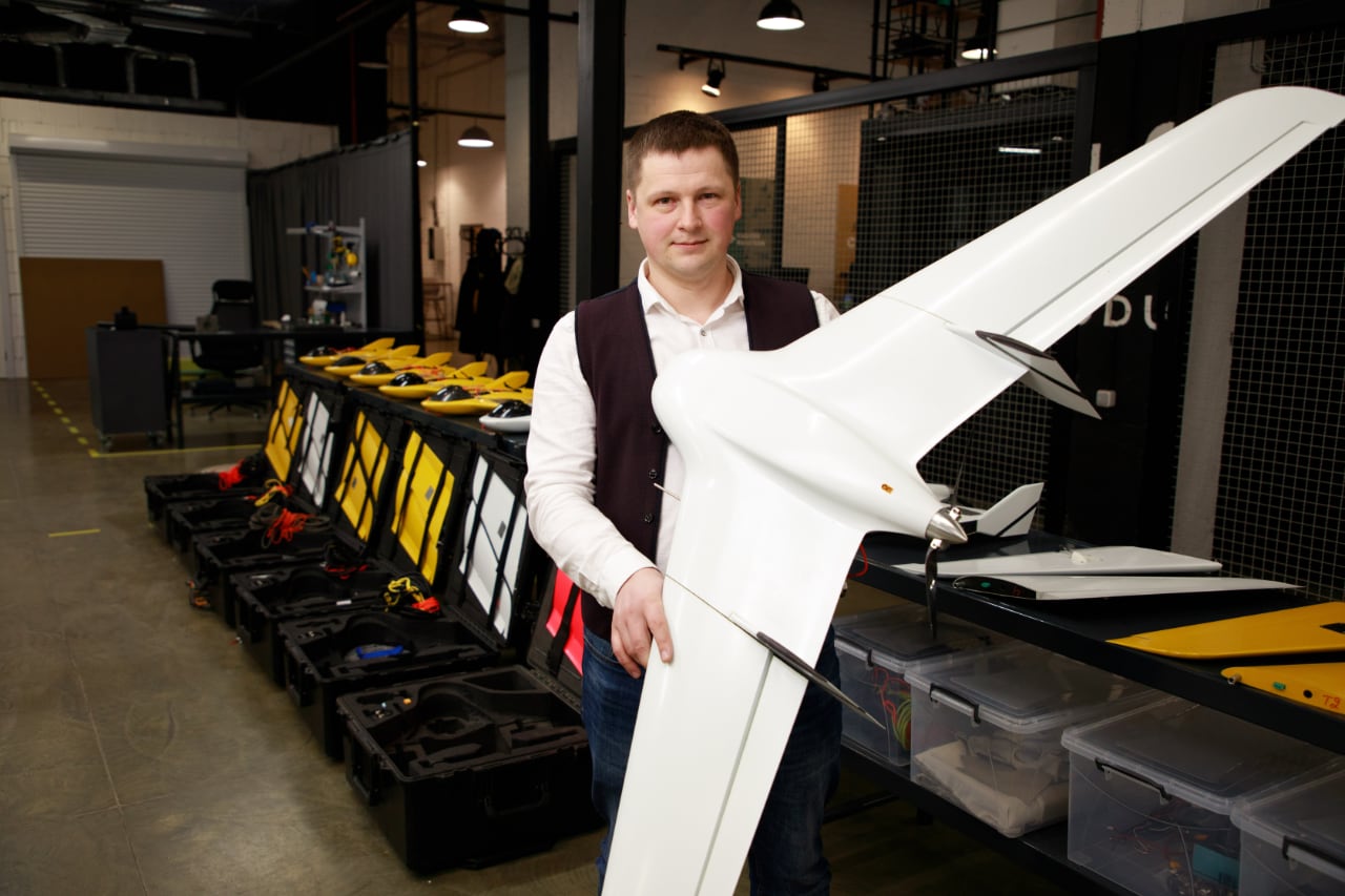
The most interesting thing is that the outside of the ищвн is almost unchanged, and if you compare what was inside the aircraft in 2016 and today - these are two different UAVs. Oleksandr Danylenko, CEO of Culver Aviation, says.
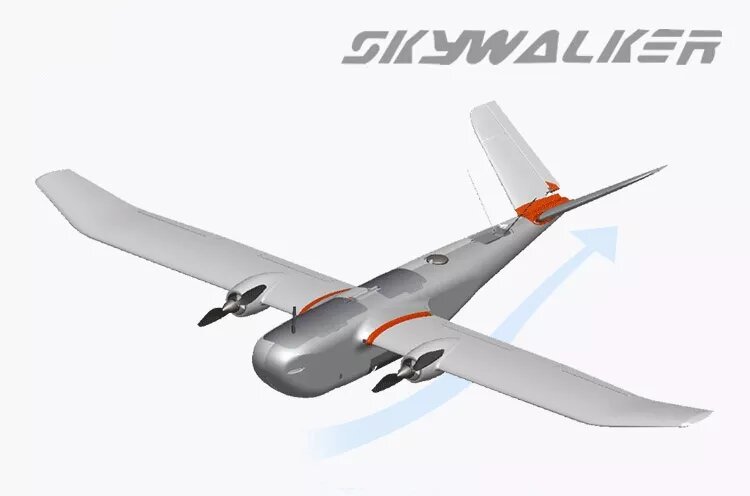
When designing and developing the body, much attention was paid to UAV's form factor. It was decided to leave it the same as the foam plane, with which ITEC began its way. The wingspan of SKIF is 1.5 meters. Such dimensions make the UAV mobile, it can be easily put in the car trunk. As Oleksandr Danylenko recalls, this is exactly the task they set - compactness: "We measured trunks so that we could load the kit into the car and it would go wherever we needed it to go. For larger planes, you need a pickup truck or a bus. So we settled on an airplane form factor of one and a half meters."
ITEC had 3 different SKIF models. SKIF TRAINER - for training beginners and amateurs. SKIF NDVI - for agricultural applications such as measuring field contours and monitoring crop conditions with the Parrot Sequoia multispectral camera. And SKIF MAPPER - for aerial photography, mapping, field contour and area measurement. Over time, the company came to a unified and versatile SKIF platform, which is now the main one in the Culver Aviation fleet.
How the UAV Camera Changed
In 2014, ITEC put a 10MP camera in the first prototypes and it was considered cool. In 2015-2016 it was 20MP, and today's SKIF has a 60MP camera, and the interesting thing here is that the size of the aircraft is still the same. The cameras used for UAV you can buy simply in the store, but....the camera is reassembled in a special housing, which reduces the weight by 30%.
The task the UAV is supposed to perform is also important when choosing a camera. Multispectral cameras are used to produce NDVI field maps (Normalized Difference Vegetation Index). It all depends on the task at hand.
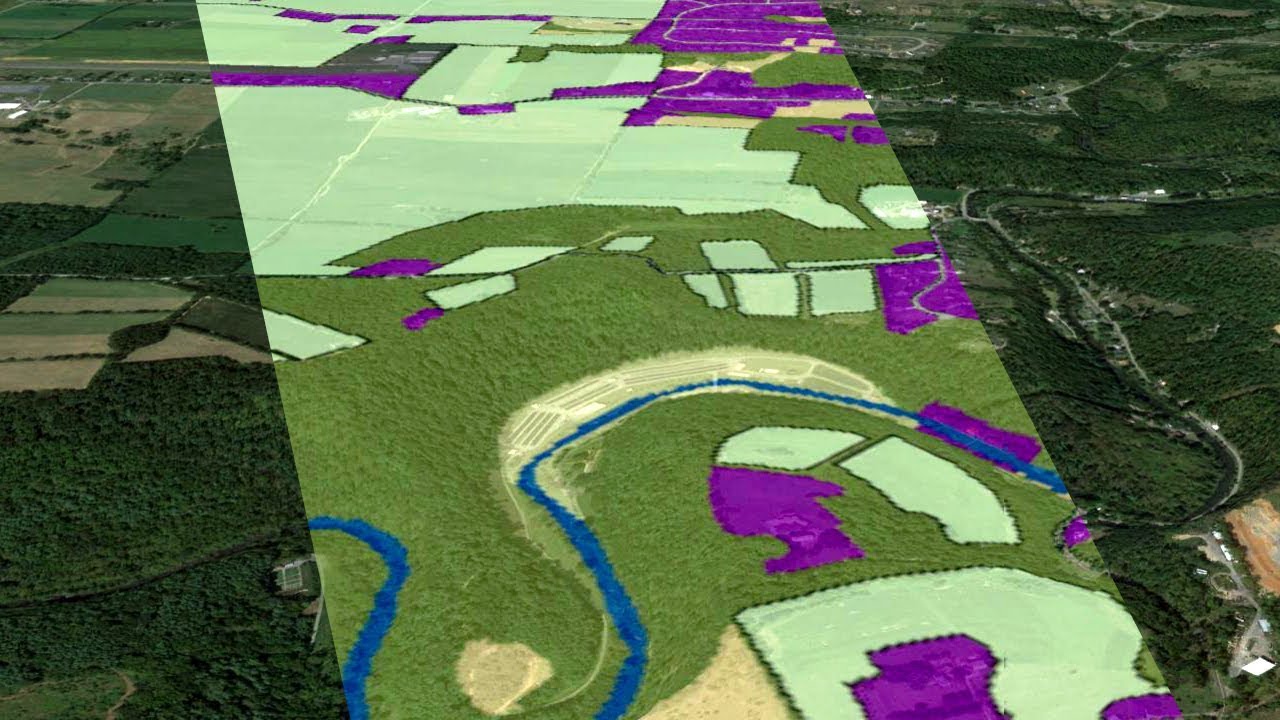
Resolution of Digital Maps
Duration of SKIF flight on one charge is up to 2 hours. During this time it can scan 1900 hectares of land from a height of 500 m and a resolution 5 cm per pixel. From a height of 100 meters - 1 cm per pixel.
Again, it all depends on the task. Usually 5 cm per pixel is enough for clients. The interesting thing is that those who need 1 cm per pixel will have to pay more for terrain scanning. Not 5 times more, but it will be 2-3 times the difference. After all, you have to go lower and spend the same amount of time to capture a smaller area.
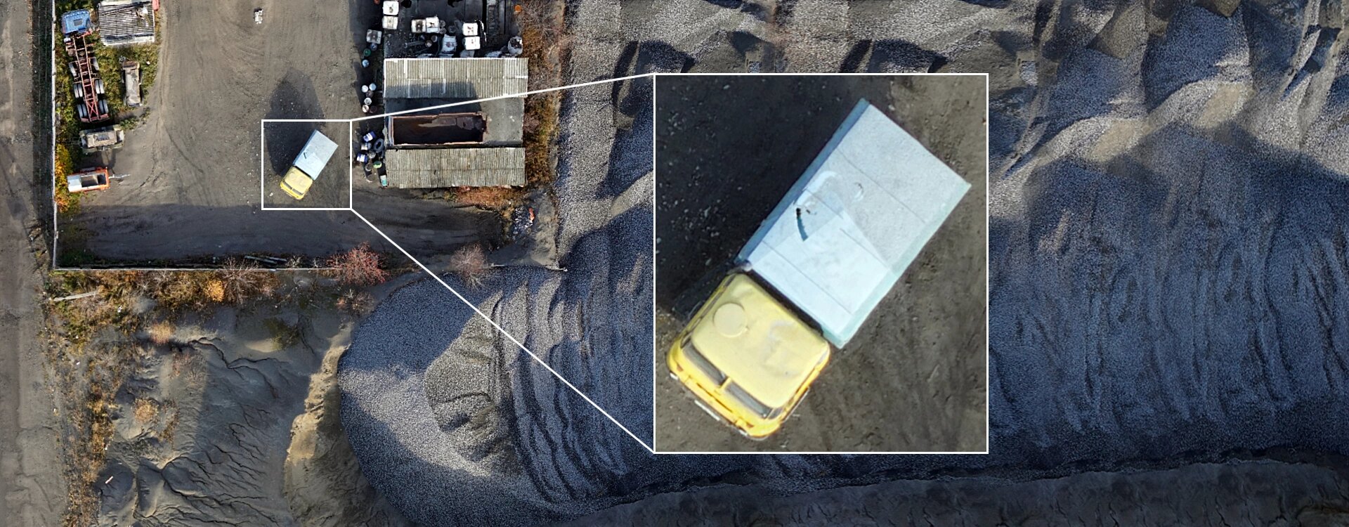
61 MP Sony Alpha A7 Mark 4 camera gives a resolution of 1 cm per pixel from 100 meters, so you can see individual leaves and small stones on the road.
What Fields the SKIF is Applied at?
- Agro-sector - to measure fields, monitor the condition of crops, track problems in a timely manner.
- Natural reserves - to assess resources, monitor illegal logging, refine the map of trails and precise positioning of sites.
- Natural disasters - assess the extent of destruction and damage, consequences of flooding
- Roads - assess the visual condition of roads and nearby facilities, pavement quality, analyze terrain and elevation differences before design.
- Spontaneous landfills - analyze areas and accumulations.
- Pipes, power lines - check integrity, quickly find places of bursts.
What's Inside the SKIF?
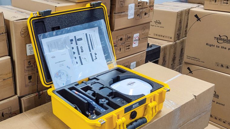
- Payload: There is an onboard geodetic receiver with real-time kinematic (RTK) technology - an application of geodesy to correct common errors in modern satellite navigation systems. The UAV is also equipped with post processing kinematic (PPK) with global navigation satellite system (GNSS) - this determines coordinates (location) using Rover (mobile GNSS signal receiver) and a correction process after data collection using corrections from the reference station, allowing results with an accuracy of 1 cm and update rate of 20 Hz without having to do planimetric preparation.
- Navigation: Navigation systems from TERSUS, with which Culver Aviation has an exclusive production contract. Thanks to them the final digital map has high coordinate accuracy. The system helps agrarians to precisely measure fields and plan budget for the sowing season.
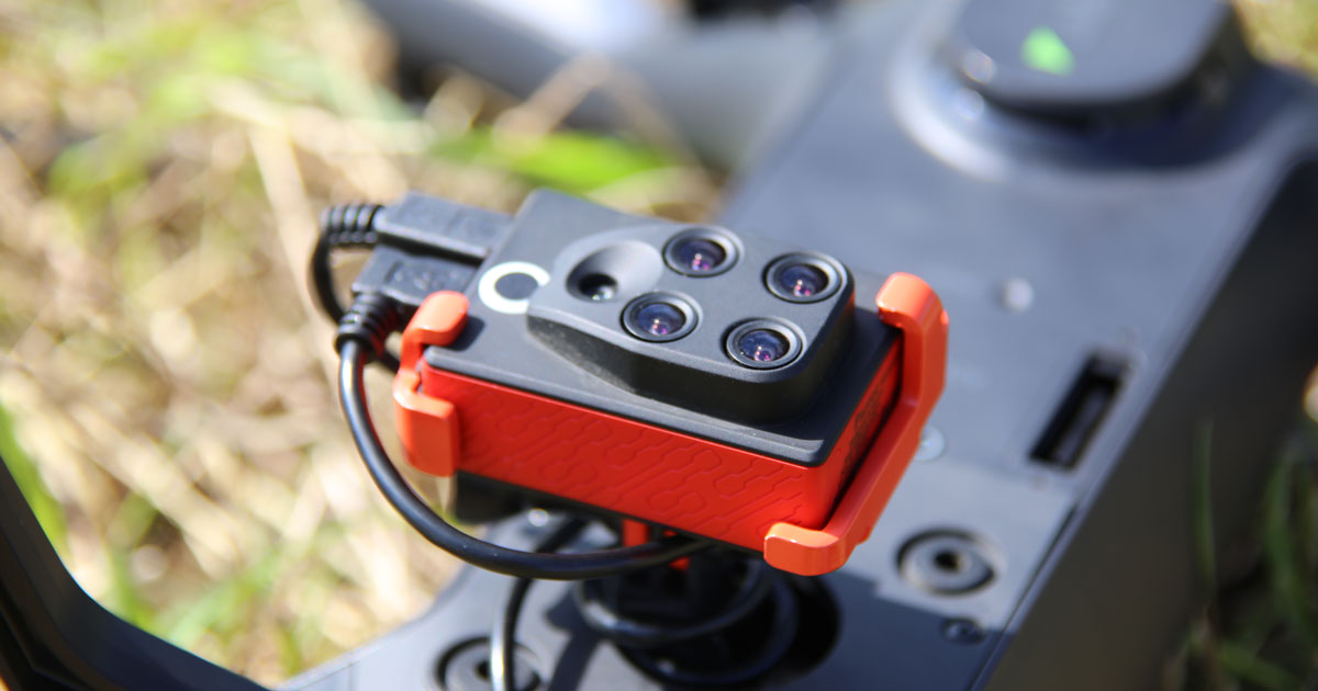
- Camera: A 61 MP full-frame mapping camera and an optional multispectral camera are on board.
Safety System:
- Automatic avoidance of other aircrafts in the air
- Inertial navigation system. Turns on in case of emergency loss of main on-board navigation
- Engine and servo lockout. Protects operator while working near SKIF UAV
- Autonomous GPS beacon. Allows tracking the location of SKIF UAV at any distance via GSM network
- Automatic parachute system. Opens the parachute in case of an emergency in the sky
Fly Features
- Distance and duration of the flight: Preparation time for launch is 15 minutes. The flight duration is up to 2 hours and the maximum distance is 130 km. Flight duration and distance depend on weather conditions: wind speed, route complexity and the number of charges/discharges of the electric batteries. SKIF goes to the skies thanks to an automatic hand launch using a 40m length elastic catapult.
- Weather conditions: Recommended wind speed - up to 10m/s in flight. Maximum allowed speed - up to 14m/s in flight. Operating temperature -15 to +35°C.
SKIF UAV flight and landing using the parachute system
Company Potential and Comprehensive UAV Applications
Culver Aviation does not sell its UAVs, it provides services with them. SKIF in this situation is a tool that can provide information, reports, orthophotomaps. More often than not, people want field measurements that include an orthophotomap. There are also requests for overflights of fields with plant growth control. Why do they do it? To see and analyze how the sowing season was, how the growth is going and whether it is necessary to correct something, add more, refill and get additional 5-10% of the crop.
By the way, Culver Aviation can also conduct a survey of vertical objects and structures - a quadcopter of its own design is used for this purpose. Thus it is possible to survey high objects such as telecommunications, towers, power lines. As a result of the survey the customer receives, among other things, data on the integrity and slope of the structure, the extent and condition of power lines, 3D model, orthophotoplane of the surrounding area and a report with the available survey materials in a convenient format.
Culver Aviation's services consist of: UAVs, operators taking site surveys and software, and a team that processes the data and produces the results. As the commercial director of Culver Aviation Serhiy Ivanov says: "Our product is not a UAV, our product is a complex.
Flexibility is also a trademark of the company. There are cases when they come with a task that no one has done before, and the team adapts its capabilities and its equipment. It is not so difficult to do, because they developed it all themselves, so the process with adaptation will take much less time. Serhiy Ivanov said that the company has found a unique business model for the Ukrainian market.
We develop, produce and use UAVs ourselves. People can come to us with a request that isn't yet on the market, but we will be able to implement it. We can make it flexible, fast, and guaranteed.
How the UAV Market Works for Farmers
We live in an agricultural country, and farms have long started using drones for work. But large agribusinesses need complex tasks because they operate large tracts of land. Larger UAVs, which can handle more work, are better suited for this. For example, one copter can scan a maximum of 70 hectares per day. A UAV can do 10,000 hectares in 4-5 flights per day. The use of such a UAV requires training, special software, and skills. Therefore, it is more profitable for agrarians to focus on their own business instead of mastering another profession. They do not need UAVs so much as they need answers to their questions - what, where and how to cultivate. Therefore, it is more profitable for them not to buy aircraft, but to order the results of their work as a service. It is also more profitable for the UAV manufacturer to provide such services, instead of selling and maintaining the aircraft. Over time the manufacturer can make more profit on such services than on selling an UAV. Agrarians abroad were the first to realize all this and started buying services instead of planes. Therefore, Culver Aviation sees prospects here both for the domestic market and for the export of its own services using UAVs.
Support for the Memorandum "Russia will Pay"
"Now Culver Aviation will provide another service, but for the whole country - we will help assess the damage from the war in the memorandum "Russia will Pay," says Oleksandr Danylenko.
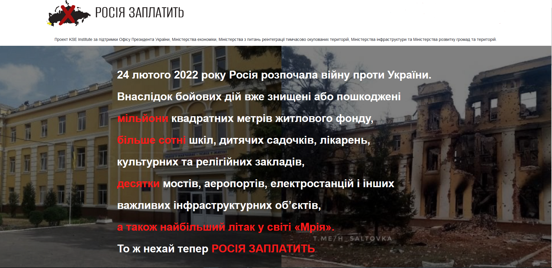
Culver Aviation joined the project damaged.in.ua launched by the KSE Institute together with the Office of the President of Ukraine and the Ministry of Economy. A memorandum "Russia will Pay" was concluded between the national governmental organizations. They collect data on material damage caused to citizens and the state as a result of Russian aggression. These data are needed by the Ukrainian government to assess the damage incurred by the state and citizens of Ukraine as a result of Russian aggression and to form claims against Russia in international courts for compensation for these losses.
Anyone can provide information about the destruction and damage caused as a result of Russian aggression. The type and name of the object, the city and region where the object is located and the date of destruction should be specified. It is important to collect data on the destruction of infrastructure, large administrative objects and high-rise buildings: bridges, airports, schools, hospitals. In order to do this - you need to fill out a special form on the website.
The need for external damage assessment is great. Large scale objects are difficult to comprehend and require climbers. If the object is large - it will take several days. But an UAV can perform the same task many times faster. With their expertise and aircraft, Culver Aviation wants to streamline the process of gathering information about the destruction. That's why they joined this memorandum.
And if you also want, in the future, to speed up processes with information processing and run the UAV, the company also told me what it takes, and also discussed what the shortcomings are in the educational system of our country.
About the Higher Education System in Ukraine
This topic is definitely relevant to anyone who is currently getting higher education. Answering the question whether our higher education institutions can prepare ready specialists at once, Oleksandr Danylenko says that no institution prepares ready specialists to the fullest extent, but gives a good basis.
The main problem is that students lack modern facilities during their studies. If our universities want to graduate specialists capable of designing and constructing drones right away, they need to provide modern equipment. How can this be done? One of the options is to encourage business to invest in the educational field, so it can help to young specialists. According to Oleksandr Danylenko, the company is also working in this direction and will soon announce cooperation with one of the Ukrainian universities.
Where to Start in the UAV Field?
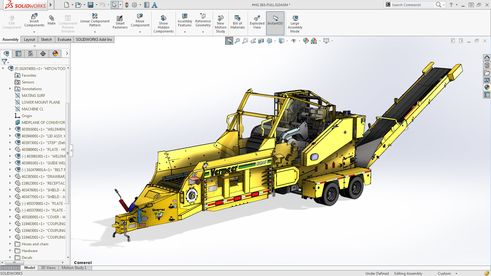
First, you need to decide on the direction. There are three basic ones: electronics, programming or design. If, for example, you chose design, you need to start studying the design software programs. One of the programs for 3D modeling is SoildWorks.
How to Become a Part of Culver Aviation Team?
The easiest way to join Culver Aviation is to attend Drone Control School. This is a free course where you will learn how to operate a professional UAV. The course does not require any special knowledge or skills, just the desire to be a UAV operator. After successful completion of the course you may have 3 directions for further development:
- Defense of the country: with the help of drones you can perform tasks for the defense of the country
- Work at Culver Aviation: after completing the interview and course, students can get an UAV operator position in the company
- Freelancing: Any kind of aerial photography assignment can be done with a UAV. UAV operator is an in-demand profession these days.
Anyone can learn to fly an UAV. According to Oleksandr Danylenko, their school graduates skilled operators regardless of gender, profession or job.
What's Next?
Having started assembling the first UAVs without experience or great capabilities, over the years the company has transformed, started providing services to agrarians and is about to count the losses from the war in Ukraine.
"The hardest part was finding motivation after a sequence of failures and unsuccessful experiments, but you have to keep going," shares Oleksandr Danylenko.
And, when things seemed to go right one common obstacle emerged for us. Each of us had to adjust to the new realities. Now some of Culver Aviation stayed in Kyiv, some moved to a new office in western Ukraine, while others joined the AFU and are defending our country. The sky is now closed for commercial companies, and the team is already looking for opportunities to continue providing services, because despite all attempts of the enemy, the sowing season continues and the farmers are working at 100% and need agro-monitoring of the harvest. At the same time, the company is working on new developments that should say a new word in the global UAV market. This story teaches us that success awaits those who go and do not stop no matter what. For me, Culver Aviation was an example that war is not a verdict for development and new steps into the future. Now each of us is part of the new Ukrainian future, which is already on our doorstep. In conclusion, I would like to tell everyone that, no matter how hard it is: you have to dream, because dreams are the beginning of such stories. Everything will be Ukraine.
For those who want to know more
- Unsurpassed weapons: Ukrainian kamikaze drones (loitering munition) ST-35 Grom and RAM
- Why is there so much talk about the MLRS M270 and M142 HIMARS? We understand why they are important, what missiles are used and how they can change the course of the war
- Not only Excalibur: the history of precision-guided munitions for 155 mm guns from the M712 Copperhead to the M1156 PGK and what they can give the Armed Forces

Our game editor has been playing games since he was 4 years old and can't imagine himself without it. He has played 100+ games on PlayStation, but still considers The Last of Us Part II to be the best in the industry. In January 2022, he joined the gg team. He studies at the Faculty of Journalism at Kyiv International University.