No GPS? No problem: quantum gravity navigation just passed its first sea trial

GPS jamming and spoofing have become routine threats at sea, with more than 978,000 incidents recorded globally in the first quarter of 2026 alone. Australian quantum technology firm Q-CTRL has responded with GravNav, a navigation system that ignores satellites entirely and reads Earth's gravitational field instead. In August 2026, the company completed the world's first GPS-free quantum gravimetric maritime trial in the Coral Sea — hitting roughly 1 nautical mile (1.85 km) of positioning accuracy over a 56-hour run aboard a 29-metre vessel.
How gravity replaces satellites
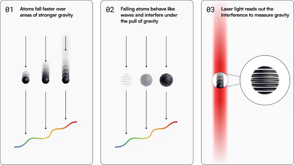
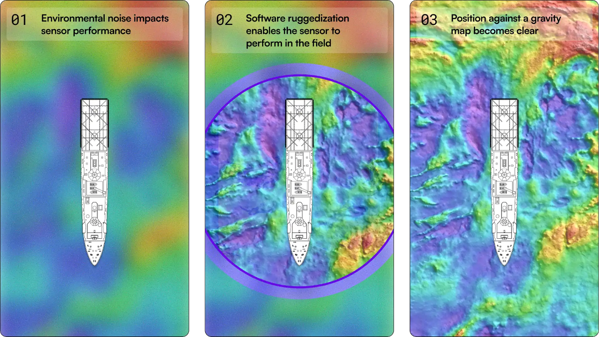
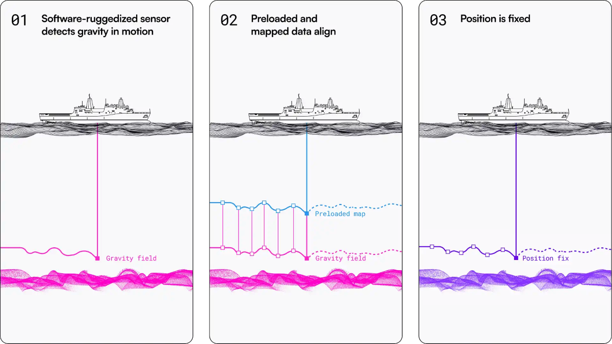
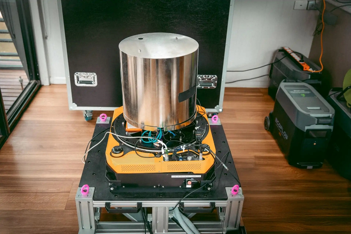
GravNav uses cold-atom interferometry — a quantum sensing technique that detects microscopic variations in gravitational pull — paired with conventional accelerometers. The system compares live gravitational readings against pre-existing maps of Earth's gravity field to fix a position. Because it emits nothing and receives no radio signal, it is entirely passive. There is nothing to jam and no signal to fake, since gravity itself cannot be spoofed.
During the Coral Sea trial, the hardware sat in the vessel's passenger cabin with no special mounting infrastructure or complex temperature stabilisation — a significant practical difference from the bulky gyroscopic platforms typically required for precision inertial navigation at sea.

Defense first, civilian later
The immediate users will be military. Q-CTRL has confirmed partnerships with the UK Royal Navy, the Australian Department of Defence, DARPA, and Lockheed Martin. Jamming hotspots in the Red Sea, Black Sea, and Strait of Hormuz have created real operational urgency for NATO vessels — a GPS blackout in those corridors is no longer a theoretical risk. The UK's Defence Science and Technology Laboratory (Dstl) is already running a Quantum Sensing Programme aligned with exactly this kind of positioning, navigation, and timing (PNT) resilience.
Q-CTRL previously tested a magnetic-field variant called MagNav for airborne and land use. The shift to gravity for the maritime version reflects the superior quality and global coverage of ocean gravitational maps. No commercial pricing or civilian deployment timeline has been announced, as GPS World notes. For now, this is a defense-grade backup — but one that requires no special infrastructure to install on a standard vessel, which could eventually make the jump to merchant shipping far simpler than retrofitting traditional inertial navigation systems.


